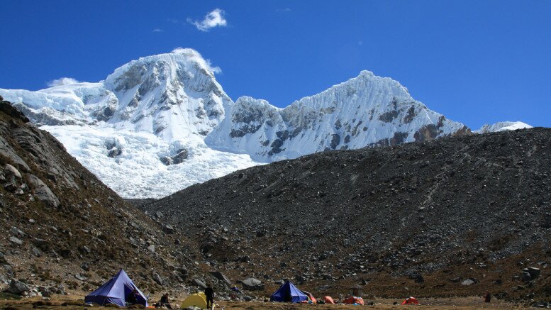
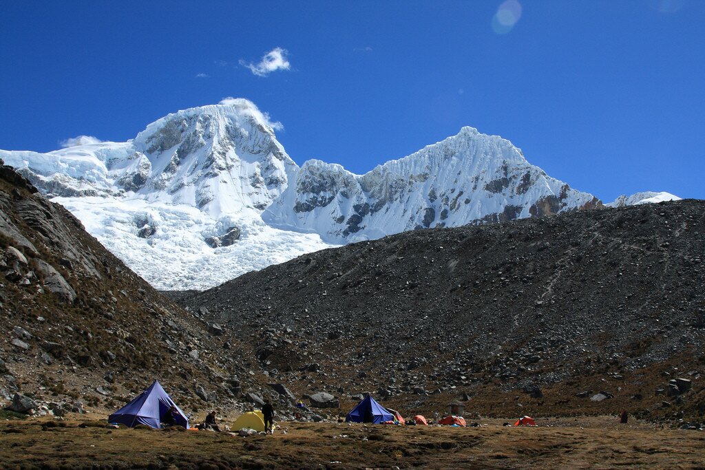
After hiking Laguna 69 and camping by the lake side, you have two options for the second day: descend the same trail as the previous day to Cebollapampa, or climb an extra 400 metres / 1300 feet up the “high route”, rounding the mountain and approaching Pisco base camp from above. This second option is clearly much more fun, which is why I found myself climbing towards an altitude of 5000 metres at 8 o’clock in the morning. However, I wasn’t about to get out of my sleeping bag until the morning sun cleared the surrounding peaks and hit the tent. Luckily the views out of the tent were pretty good…
Laguna 69 to Pisco base camp
Location: Cordillera Blanca, Peru
Distance: 8 km
Days: 1
People seen: 4
Difficulty: 3/5
Accommodation: Llanganuco Mountain Lodge or Huaraz
Guidebook: Cordillera Blanca North trekking map
The trail to Pisco is relatively new and seems to be known as the “high route” or the “Pisco High Route”. It is marked incorrectly on the Sky Line adventure map, which shows it contouring around the mountain at a lower altitude: make no mistake – you need to earn this 5000 metres the hard way. The start of the trail was somewhat lost under boulder falls, but I just kept the path further along in sight and quickly found myself on a clear, smooth, if steep, dirt path.
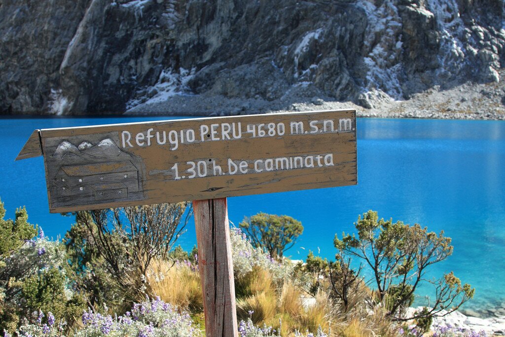
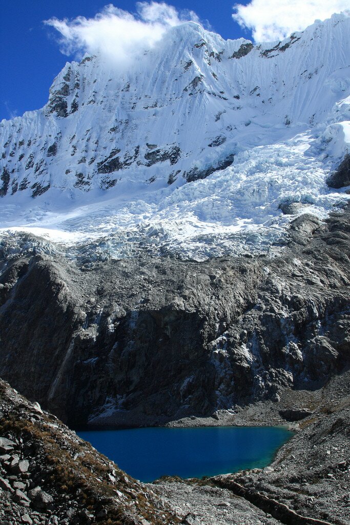
The sign next to Laguna 69 proclaiming “Refugio Peru 1h 30mins” was clearly erected by a hopeless optimist – not that I wanted to rush the route (the altitude and views are both so great) – but it was nearer 5 hours before I reached the refuge, going very very slowly and stopping frequently for photos. Every step of the way gave better views over yesterday’s landscape – the brilliant blue waters of Laguna 69, the path I had climbed up from the smaller lake, and even the entire Yanapaccha valley – the side trip I had started on before turning around.
For some reason this 400 metres sapped me much more than the 800 metres I have climbed the previous day and I briefly considered turning around and descending. However just as I was almost out of energy, really feeling the effects of the thin air, I hit the last climb, crossed a steep scree slope, and dropped down some steep rock steps to appear on “the other side” of the mountain. All around were even more spectacular views that had been hidden from Laguna 69 – across the park, over the Pisco valley, and towards Huascaran, Peru’s highest peak.

Surrounded by 6000 metre mountain peaks! (Click to view the full 57 megapixel panorama)
This was also a nice chance for a rest as the path contoured around the mountain, requiring minimal effort and revealing, literally with each step, more and more mountains until I had crystal clear views of almost a dozen peaks. In the image above Chopicalqui (6,354m / 20,846 ft), Huascaran South (6,768 m / 22,204 ft), and Huascaran North (6,655 m / 21,833 ft) are the centre group, and there were also panorama views of :
- Pisco (5,752 m / 18,871 ft)
- Tocllaraju (6,032 m / 19,790 ft)
- Huandoy North (6,395 m / 20,980 ft)
- Huandoy South (6,160 m / 20,209 ft)
- Huandoy West (6356 m / 20853 ft)
…plus several others whose names I don’t know. Below, far, far, below, the barely visible coloured dots of tents at Pisco base camp marked the next target.

Looking at Pisco, with tents at the base camp just barely visible in the centre-left of the image
This is also where the problems started. I found the clear path continued, started to descend into the Pisco valley, crossed the mountain’s slopes, skirting the edge of the moraine, and then stopped. Dead. I searched beyond a few rocks in case they had covered the trail. Nothing. Up onto some high ground to scout: a few sections of clear path were visible, but on investigation these also stopped and started abruptly. A few cairns had been created, but these too seemed to lead nowhere.
Two large lakes – not marked on the map – were nearby, and from higher altitude I had seen that these lay just below the base camp, so I headed for them. This was probably a mistake. I spent the next 90 minutes scrambling through the moraine, over some very unstable boulders many times larger than me. A few times glimpses down between the boulders revealed quite long drops – not good for a skinny guy. I wish I had some photographs of this section, but I was so annoyed by the whole escapade I left the camera in the bag. Then, just as I was about to curse a bit, a clear path appeared – right in front of me – as abruptly as it had stopped almost 2 hours before. Within ten minutes I was at the Peru Refuge, ready to follow the easy dirt track down to Cebollapampa. I still have no idea what happened to the path – back at Llanganuco Lodge I was told it is clearly visible and easy to follow (and I can see it on Google Earth now), but my experience and that of several other people I met later suggest that is not the case! Either way, I’m not in a hurry to cross a boulder field like that again.
Pisco base camp itself is a small flat area that tour companies use to pitch their tents on the 2/3 day Pisco summit climb. This is a super popular climb offered by most companies in Huaraz, often touted as being an ‘easy’ 6000 metre peak. Clients also have the option of using the small hostel / hut here, which looked pretty comfortable form what I could tell.
The path down from Pisco base camp is easy to follow and relatively morning after such spectacular mountain scenery – a quick 2 hour descent to the (relatively) plentiful air of Cebollapampa is easily achievable. Reaching Cebollapampa I decided to camp there at the flat site between the two rivers, mainly because I couldn’t be bothered to hitch a lift back along the Llanganuco gorge at that time of day, and because I wanted to hike part of the route the following day anyway. One of the “features” of Huascaran National Park is that locals are allowed to graze their livestock throughout the park, which duly leaves a large amount of “evidence” almost everywhere. Finding a clear spot to pitch even a small tent can be quite difficult (and means that ALL water needs to be treated before drinking). Still, it is hard to complain when the views are so good.
Map of the Laguna 69 to Pisco base camp hike:
Download this kml/kmz file (Created with Garmin eTrex 30 GPS)


Great post!
I’m traveling to laguna 69 in 5 days and I wonder, is it permitted to make a bonfire near laguna 69?
Sorry for my slow reply. As Laguna 69 falls within Huascaran National Park, it is illegal to start a fire. This makes sense as camp fires and similar leave marks on the landscape which can last a long, long time – particularly where the environment is so fragile, as it is here.