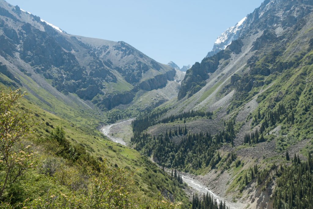
Ala Archa National Park is located in the Tian Shan mountains, around 40 km south of Bishkek. Several day hiking routes offer views of spectacular alpine scenery, fast flowing rivers, and snow-capped mountain peaks. Higher up, the alpine areas are home to the very rare snow leopard (Panthera uncia). Ala Archa’s proximity to Bishkek makes it a great introduction to hiking in Kyrgyzstan.
Getting to Ala Archa National Park
Key Facts
Location: 1 hour south of Bishkek
Distance: 4km (waterfall, one way)
Difficulty: 2/5 (due to altitude)
Guidebook: Kyrgyzstan (Bradt Travel Guide)
Accommodation: Bishkek
The quickest and easiest way to get to Ala Archa is to arrange a taxi in Bishkek. Most hostels and hotels will be able to do this for you. The driver will take you to the trail head and wait there for you while you hike. A key advantage of taking a taxi is that you arrive directly at the trail head (Alplager), which is some 12km after the park entrance. We arranged our taxi through Apple Hostel – a place we would thoroughly recommend staying.
It is also possible to take public transport to the park – marshrutka 265 from Osh Bazaar should get you to the park gate. From there you will need to get a ride for the remaining 12km to the trail head (Alplager) – taxis may be hanging around or it might be possible to hitch a lift.
Hiking routes in Ala Archa National Park
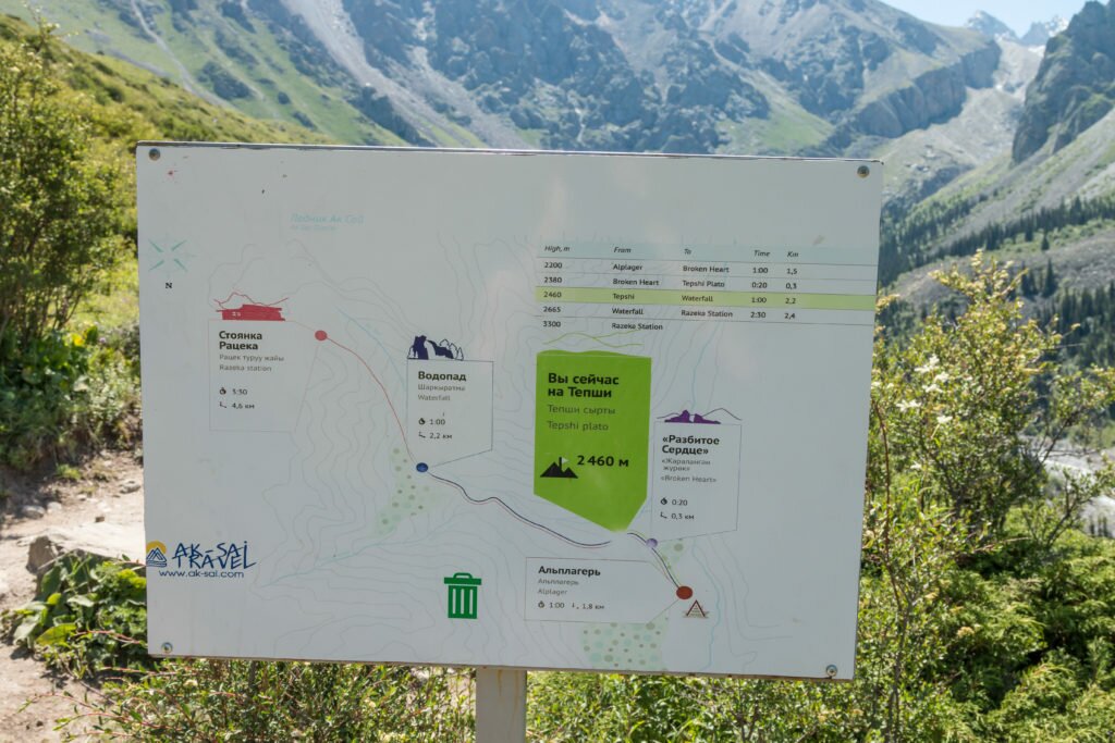
The Ala Archa map shows several hiking routes, but most are essential just different stopping points along the same linear route. This trail heads east towards a waterfall and eventually climbs to Razeka Hut and the Ak-Sai glacier. The distance to the waterfall is 4 km, with Razeka Hut being 2.4 km further on.
The alternative route heads in a southerly direction towards an old Soviet ski base. (These routes seem to sometimes be confused as the Razeka Hut on the other route is often described as an “abandoned Soviet mountain base”. Asia Hikes has a description and some great photos from this route.

Hike towards waterfall and Razeka Hut
At the Ala Archa trail head the road quickly splits in two – we took the left route to head towards the waterfall and Ak-Sai glacier. Almost immediately the route climbs quite steeply through scrub and patches of forest before emerging on a grassy hillside. At this point we made our first navigational mistake – somehow missing the main path continuing up the hill. Instead, as the trail turned east we managed to stray too far to the right (south), following the path for the short loop trail described on the map at the beginning. Luckily we realised our mistake quickly and – realising that we were also too close to the river and the path had been swept away by landslips, turned back and quickly found the correct path. This correct path climbs high above the river to offer fantastic alpine views in all directions.

The path splits – left to the waterfall; right to continue down the valley

Climbing high above the river
The first stop, reached after about an hour, was at a large rock called ‘Broken Heart’. From here we could see that most of our climbing for the day was done. Although we were heading towards Razeka hut, we knew from the beginning that we would not have time to travel there and back on our day trip, so set ourselves the waterfall as a goal instead. We could already see this target some 3 km down the valley.
The path from the Broken Heart rock to the waterfall is relatively flat and easy going, and gave us plenty of time to enjoy the mountain views and the surrounding wild flowers. A few rivers had to the crossed, but convenient stones made keeping our boots nice relatively easy.

The waterfall that was our target for the hike
It had been a while since we had been hiking together and we were obviously rusty because we made our second route finding error as we approached the waterfall. As the path re-entered the forest we lost all sight of the waterfall but didn’t really think about it until we realised we were now above it (actually we guessed, because we still couldn’t see it). In reality we had simply carried on the trail climbing up to Razeka hut, rather than taking a small and hardly noticeable side trail on the left to the base of the waterfall. Seeing as it was almost our pre-determined turn-around time, we had a nice lunch in the shade overlooking the river before retracing our steps (at least, the correct ones!) back to the trail head and our waiting taxi.

Wildflowers cover the hillsides in the summer
Ala Archa offers a great introduction to hiking in Kyrgyzstan. The trail head is at roughly 2170 metres, while the waterfall is just below 3000 metres. Ratsek hut is approximately 500 metres higher. Many popular areas in Kyrgyzstan are at fairly high altitude (for example, Song Kul is over 3000 metres), Ala Archa can be a good acclimatization hike.
Ala Archa hiking map (Created with Garmin eTrex 30 GPS)


Be the first to comment on "Hiking in Ala Archa National Park, Kyrgyzstan"