The Santa Cruz trek is one of the most popular hikes in Peru’s Cordillera Blanca, renowned as a way to see beautiful mountain scenery with relative ease (everything is relative at this altitude). Most tour companies in Huaraz offer this trek as a three or four night trip from Vaqueria to Cashapampa, or vice versa. Unfortunately the trek also has the reputation of having some quite unpleasant camp sites due to overcrowding and unmaintained facilities.
Key Facts
Location: Cordillera Blanca, Peru
Distance: 50 km
Days: 5
Camping: Wild camping
People seen: 2
Difficulty: 4/5
Map: Cordillera Blanca North trekking map
Accommodation: Llanganuco Mountain Lodge or Huaraz
Not liking to do things by the book, and wanting to avoid these problems, I packed enough food for five nights and decided to take side trips where possible and camp wherever it was quiet. Tour companies in Huaraz will tell you Santa Cruz cannot be hiked on your own, and in fact the park warden at the gate did try to stop me. He seemed appeased, though, when I told him I had friends in the park who were ahead of me. This same warden also saw me camping outside of the designated campsite and didn’t bother me, except to check my ticket.As it turned out, this wasn’t entirely necessary because I saw very few people on the trek anyway (and all going in the opposite direction).
Day 1: Vaqueria to Paria
I decided to start the Santa Cruz trek from Vaqueria, primarily because it is higher than Cashapampa and thus requires much less climbing overall. This also meant day 1 involved crossing the rather fearsome Portachuelo Llanganuco pass: a gravel switchback road that climbs, without safety barriers, 800 metres (2600 feet) straight up a mountainside – the local minibus sometimes just inches from the edge. If I had to do that again, I think I would walk it.

Hurtling up the Portachuelo pass to the start of the Santa Cruz trek
Safely deposited in Vaqueria mid-afternoon, I was quite late to start the trek, but didn’t fancy hanging around the village – a one street town with too many stray dogs. Like many of the treks in Peru, the start of the Santa Cruz trail is an odd mix of litter-strewn rural village and protected National Park, and not something I’m fond of. But after a hard 30 minute climb under cloudy skies, the path flattened out and the village, including the guinea pig farm and other tourist attractions, were left behind. At the park gate the guard accepted my story about having friends already in the park, I paid my entrance fee and I was officially in.
Like other areas in the Cordillera Blanca the land here is still used to graze animals and as I ambled through the gentle meadow-like landscape of Quebrada Huaripampa, I was occasionally interrupted by lines of cattle or donkeys being herded along the path by local men.

Quebrada Huaripampa on the Santa Cruz trek
The first camp site at Paria is only a few hours from the park gate and the area around it offered some of the better camping spots. This was also handy for the side trip to Quebrada Paria the next Wanting some peace, I opted for a quiet spot next to the river about 500 metres before the camp site, not sure whether wild camping was permitted in the park. (The next morning a ranger woke me to check my ticket, but said nothing else, so I assume it is). As cattle are allowed to graze in this area, the river water is potentially contaminated and needs treatment before consumption. I used the rather nice SteriPen.

Wild camping in Santa Cruz
Day 2: Paria to below Punta Union
After a peaceful night drifting off to the gentle sound of the river, the next day brought zero improvement in the weather – still dry but very cloudy, with no chance of seeing any peaks. I couldn’t be bothered to venture up the Quebrada Paria valley on a side trip if I would never see the mountains or the glaciers, so decided to push on up the valley, up and over Punta Union, and down towards the next camp site. Punta Union is a high pass which provides the only route through the sheer rock walls between the Quebrada Huaripampa valley and the Quebrada Santa Cruz valley. At 4,750 metres (15,583 feet) it is the highest point on the Santa Cruz trek. There are campsites far below in the valley before the pass, but camping there would have meant a much greater climb the next day.
As it turned out however, crossing Punta Union today wasn’t to be. The climb up the side of the valley is quite steep and by early afternoon I was feeling the altitude and considering camping before Punta Union and crossing it the next day. A sudden hail storm helped me make up my mind and I quickly pitched the tent next to a lake at about 4400 metres – not the best place to camp, but I figured pushing on to the pass late in the day in bad weather would be even worse. So, two days down and barely a photograph taken. Above me, I couldn’t even see the pass.

Wild camping near Punta Union
Day 3: Over Punta Union to Alpamayo Base Camp
The weather on day 3 remained much the same – dry and bright but still extremely cloudy. Evacuating the camp site quickly due to some unwanted interest from several bulls, grazing even at this altitude, I started up the path. Quickly the weather woke up too and was in a playful mood. Visibility dropped significantly, making the route ahead hard to find, then snow and hail started to fall, making it hard to see even the path under my feet. Punta Union sat somewhere above me, but from distance I wasn’t really sure which of the notches in the rock was the one I wanted. Still, I figured that with only one path over, in the worst case I could reach the rock wall and walk along it until I found the path up…

Climbing towards Punta Union
At it turned out, I was right on target, with a nice set of stone steps right in front of me as I reached the rock face. A quick climb up led to 4750 metres – my second highest altitude on the Peru trip after Laguna 69 – and a two metre wide groove in an otherwise impregnable rock wall. Around me, a magnificent view of…white and grey. Ahead…white. Behind….white. Beneath my feet, fresh snow – one thing was for sure, nobody had been up here this morning. I wonder why?

Footprints in the snow at Punta Union

Punta Union

Descending from Punta Union
I snapped the requisite photos, shook the snow off my bag and clothes, and started down. Wow! Very slippery – a nasty combination of ice-covered paths and sheer drops! I descended slowly, keeping in mind that “every step down means more oxygen”. After a long, slow descent, past several other groups and a few mules with their handlers, I reached the more hospitable altitude of Taullipampa, at a mere 4200 metres, and decided to push on across the flat valley floor to the next camp site. But the adventures weren’t over yet!
In March 2012, a combination of heavy rains and an avalanche caused a lake to burst its banks and create a massive landslide in the Santa Cruz valley, starting in the corrie between Nevado Artesonraju and Nevado Paria and sweeping down the valley. The hillsides were ripped away, the Rio Santa was diverted, and the once steep-sided Santa Cruz valley was filled with millions of tons of rock and earth. Amazingly, despite stretching for 8 miles, the landslide killed nobody.
While I was aware of the landslide and the new route the path now took, I was not aware that my planned camp site had also been washed away! Worse, the landslide was so strong that any flat, treeless areas were torn up, meaning finding a wild camping spot was also impossible. The only remaining spots were heavily forested and steeply sloping valley edges, and the new and unstable sheer cliffs meant getting to the river for drinking water was impossible. Not good.
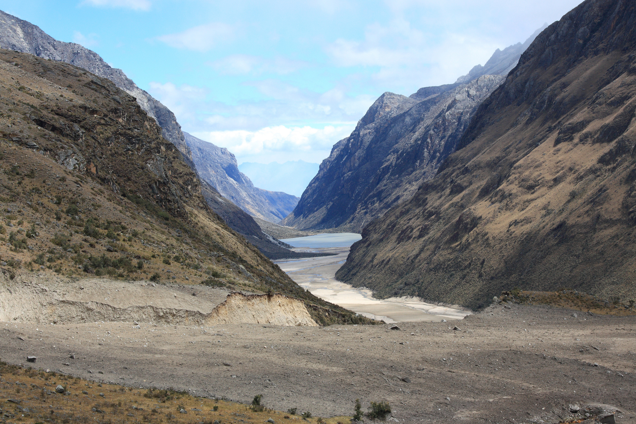
Landslide debris stretching for miles – campsite washed away
The only viable alternative was to climb up the valley sides along the trail to Alpamayo – not to much of an inconvenience since the point of this trek was to see the mountain anyway. So, I regained 400 of the metres I had just lost and headed up the Alpamayo valley to the base camp, and another night at over 4300 metres. Here a small group of hikers and climbers were camped, waiting a break in the weather to attempt Alpamayo’s summit.

Artesonraju (6,025 m / 19,767 ft) – often considered to be the mountain in the Paramount Pictures logo

Camping below Alpamayo
Day 4: Alpamayo Base Camp to Llamacorral
Finally, the weather had improved. The previous night I met a group of climbers who had been waiting three days at the base camp to have a crack at Alpamayo. They had even been up to the high camp once but forced to retreat after the weather closed in. This morning it looked like they would get their chance. Hopefully I would get some good views too!
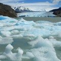
Shaking the ice off the tent, it was too cold to hang around, so time to nip up to the glacial lake Laguna Arhuaycocha (4420 m / 14,500 ft) to take a spot of breakfast before descending. One of the great things about the Santa Cruz trek (and the Peruvian Andes in general) is that there are often all kinds of side trips and special sights hidden away just off the main trail. Lake Arhuaycocha was only 100 metres above the base camp full of people, but it remained hidden until I was on top of it and was completely deserted.

Laguna Arhuaycocha

Alpamayo scenery
I retraced my steps to the start of the valley and set off across the rather eerie new landscape formed by the landslide. A new path has been marked, but the ground is perfectly flat and featureless, so you need to keep your eyes open. Along the way, half-buried trees give an indication of just how much rubble fell into the valley. The two lakes – Laguna Jatuncocha and Laguna Ichicocha – have also changed, with the latter now being quite small. The route is hot, windy, and not very exciting – best to cross it as quickly as possible.

Landslide damage

Tree half buried by landslide debris in the Santa Cruz valley
Rather than push forwards the extra 3 hours to Cashapampa, I decided to camp in Llamacorral at the far end of the second lake, since I had five days of food anyway. There was a rare patch of flat, smooth grass to laze around on all afternoon and the high altitude sun gave me a good chance to dry everything out. At Llamacorral there is also a small shop selling snacks, sodas, and beer at exorbitant prices.
Day 5: Llamacorral to Cashapampa
A straightforward day – the path follows the Santa Cruz river, descending slowly at first and then quite steeply – I was definitely glad I came down this route rather than starting from Cashapampa. From Cashapampa it is easy to find rides back to Yungay or Huaraz.

Back to Cashapampa
Santa Cruz Trek Map:
Download this kml/kmz file (Created with Garmin eTrex 30 GPS)