
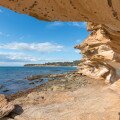
The Fimmvörðuháls Pass is one of Iceland’s most famous hiking routes, starting in Þórsmörk (sometimes written ‘Thorsmork’) and running between the Eyjafjallajökull and Mýrdalsjökull glaciers to Skógar on the south coast of the country. In clear weather the route offers expansive views over the two glaciers and out towards the North Atlantic Ocean – but more often the summit is covered in cloud making route-finding extremely difficult. Despite the large bright yellow trail markers excellent navigation skills are required – this is an active volcano after all and straying off the path is ill-advised. Do not count on a GPS working here either. The trail can be completed in a single long (10-12 hour) day, or by splitting it at the new hut built on the pass (these need to be booked in advance). The old hut, more of an emergency shelter, is in poor condition and I would not like to spend a night there (as we will see). The Fimmvörðuháls Pass can also be hiked as an extension to the Laugavegur trail from Landmannalaugar.
Key Facts
Location:Iceland
Distance: 22 km
Days: 1 or 2
Camping: Campsite with facilities
People seen: 2
Difficulty: 4/5 (due to weather)
Guidebook: Walking and Trekking in Iceland
Accommodation: Skógafoss
The now infamous 2010 eruption of Eyjafjallajökull caused all kind of disruptions in the Þórsmörk area, but the Fimmvörðuháls route was open again relatively quickly thanks to temporary bridges over the newly routed rivers in the Þórsmörk area. These new rivers made all of the maps of the valley completely useless, of course.

Temporary bridge over river
From Þórsmörk the path climbs quickly above the valley, with some steep sections having steel cables embedded into the rock to help walkers. Apart from these few exposed sections though, the first hour is a relatively easy walk with beautiful scenery. One tricky part is the thin ridge known as The Cat’s Back. With long drops in each side this would be a dangerous undertaking in windy conditions.

The “Cat’s Back” section

About to leave the greenery and enter the mountains
As the greenery stops and the “mountain proper” starts, the Morinsheiði plateau is reached and – unfortunately for me – the weather closed in, with freezing fog dropping visibility significantly. I could literally see the clouds hanging above, just waiting for me to climb the path up, into them.

Morinsheiði plateau – a calm, peaceful place
There is something strangely calming about walking on a very faint footpath over featureless terrain in low visibility.
At the far edge of the Morinsheiði plateau is the most exposed part of the walk – a short section which travels across the top of a steep slope with slippery ascent at the far end. Again cables have been placed in the rock here, but care needs to be taken not be meet people coming the over way (the section bends around slightly) as passing would be difficult and dangerous. In clear conditions (hah!) the next section would offer views of the surrounding glaciers – instead, it was a long trudge through snow, struggling to stay on the path and frequently checking navigation.

Hiking across the top of this slope, aided by fixed chains
In the section most affected by the 2010 eruption the path breaks up completely, ducking and darting over recently hardened lava between steaming vents and thin looking lava crust. At times it felt like the Earth could easily open up and swallow me. On one occasion, slightly disoriented by the low visibility, I found myself slowly descending in a gentle clockwise curve – and realised the fog was no longer mist but smoke, and that I was descending into a small crater!

Crossing lava, trying to stay on the path in low visibility

New, multi-coloured lava on the pass
The path here is marked by high fluorescent yellow markers every 50 metres or so, but the visibility was so poor that seeing these was not always possible. I had to be careful to keep each marker in sight behind me until I was certain I could see the next – sometimes venturing out into the unknown in what I hoped was the right direction, before having to turn back and try a new one.
About halfway across the plateau a signpost directs hikers to the Útivist hut where you can spend the night. This is apparently a new hut with excellent facilities. Carrying on, a short while later the route reaches an older hut called Baldvinsskáli which is unattended and suffering somewhat from the environment – damp and full of mold. Not the kind of place you would want to spend the night unless you really had to. As I arrived, two hikers had just found the hut after being out in these conditions – lost – since the previous morning. They had left the trail to look at the glacier the previous morning and the weather has closed in between them. Luckily they had carried a tent with them, although no sleeping bags. They are understandably happy – and very lucky – to have found the hut in those conditions.

The old Fimmvorduhals emergency shelter
From Baldvinsskáli it is about 4 hours down to the camp site at Skógar, with the option of following the road down (easier in poor visibility) or taking the walking path. Many waterfalls and streams are passed on this route, especially on the walking trail. From the road I could hear them but barely see them because of the visibility.

Camping in Skogar after a long, hard hike
Map of the Fimmvorduhals Pass hike:
Download this map/kmz file


Be the first to comment on "Fimmvorduhals pass between Eyjafjallajökull and Mýrdalsjökull"