Boqueron volcano (also known as Quetzaltepec) is visible from virtually everywhere in San Salvador city. With the relatively recent improvement in infrastructure, the Boqueron National Park on the crater rim is becoming an increasingly popular destination for local and foreign tourists alike.
Key Facts
Location: San Salvador
Distance: 5.5 km
Time: 2-3 hours
People seen: 0
Difficulty: 3/5 (exposure danger)
Guidebook: Moon El Salvador (2014)
Accommodation: Accommodation in San Salvador
Within the park itself the only path is a short trail from the car park to the crater rim, but it is also possible to leave the park and walk around the rim, or descend to the crater bottom. In both cases, the usual precautions about checking the local security situation apply. Fairly obviously, the crater rim path is far easier than the crater descent. The rim trail has very little change in elevation, although there are a couple of very brief exposed moments.
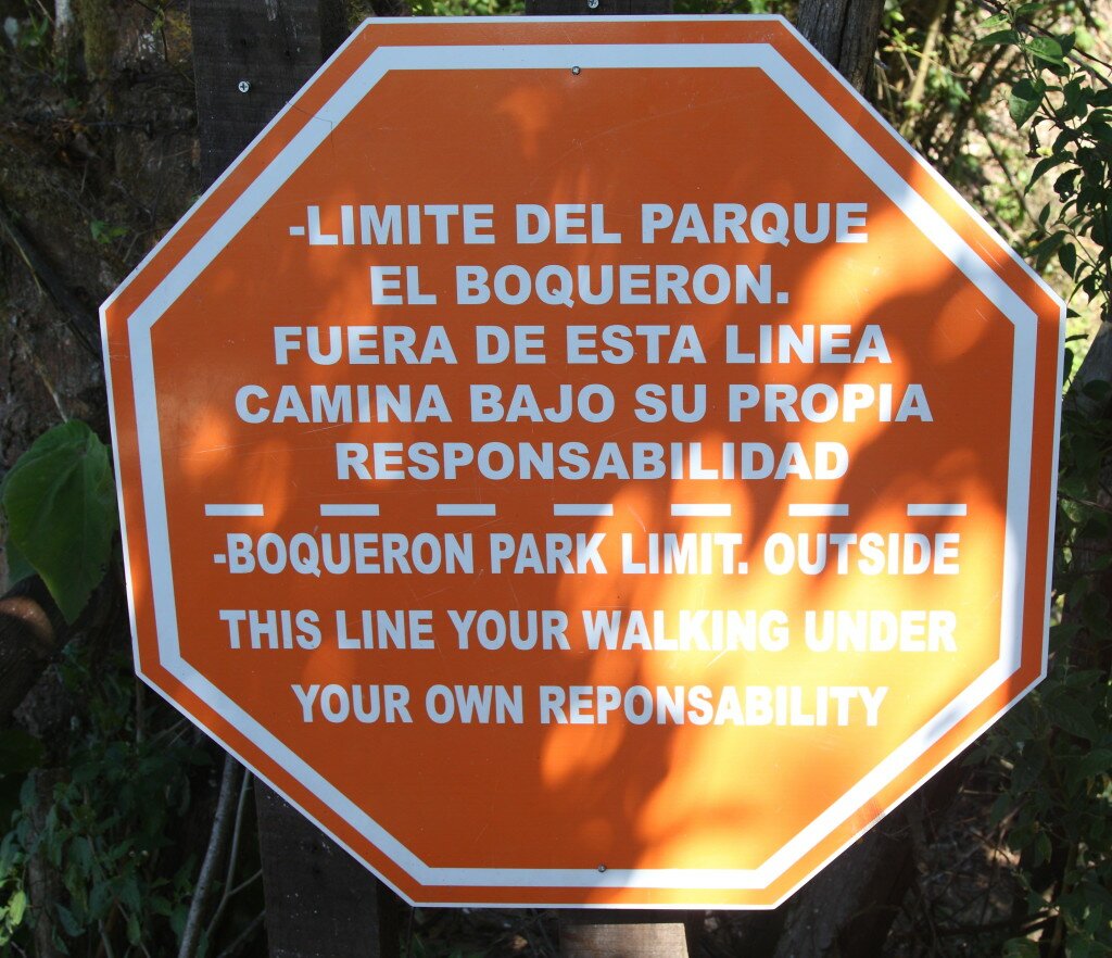
The path starts at the cafe on the rim, after the sign notifying you about leaving the park boundary, near a short wooden bridge. To reach here you turn left at the crater rim (walking clockwise around the crater). Passing under the bridge, the path immediately climbs, with the cafe on the left.
The trail for the first half of the hike is good, as it is used by locals who live and work on the far side of the volcano slope (there is even a house built right on the edge halfway around). At this point it is possible, on a clear day, to see as far as Santa Ana and Izalco volcanoes, nearly 40 kilometres away. The path also offers a unique angle on Boqueron crater and the Boqueroncito cinder cone inside.
The second half of the hike sees the trail becoming less distinct. In one section there is a very clear and wide path that runs perpendicular to the rim trail, directly down the outside of the volcano. This is not the correct route. As a rule the path always follows the rim very closely, never really moving away from it. Sometimes it moves very close indeed – there are some short sections that are extremely exposed, where a fall would be guaranteed fatal. If in any doubt, there is always the option of turning around and going back the way you came.
Map of the Boqueron crater rim hike:
Download this map / KML file


Hey this is super useful, thanks! I want to do this – did you take a guide? If so, how did you organise it? I live in San Salvador and asked the guards at the official park office, who claimed no knowledge. Any advice welcome! Thanks for the great site 🙂
I didn’t take a guide – the route around the rim is unofficial.
When I was a kid in San Salvador it was a treat for all neighborhood kids to climb the volcano. I remember my mother fixing us bean sandwiches for the climb. We would start early in the morning by taking a bus to a town in the skirts of the volcano. We would either climb to the crater or to the Picacho. In those days it was very safe and we used to do it without any adults. It would take us 4-5 hours for the climb, we would stick around the crater for an hour or two before returning. If you live in El Salvador you owe to yourself to at least visiting the national park. From the park parking lot the crater is an easy 15 minutes walk.
Thanks for your post Carlos. It really is a great trip.